By the D2 Holidays Srinagar desk
Local operations team on Boulevard Road, Ghat No. 7. We plan family packages, cab days and high-pass day trips from Srinagar.
Last checked: 30 Sep 2026
Direct answer
Sinthan Top is a high mountain pass on NH-244 between the Anantnag (Kokernag–Daksum) side and Kishtwar. From Srinagar the usual tourist drive is about 130 km via Anantnag–Kokernag–Daksum (roughly 4.5 to 5.5 hours one way in clear conditions). Kishtwar district's official tourism note lists the top at 3,784 metres. As of the J&K Traffic Police advisory reprinted for 29 Sep 2026, Kishtwar–Sinthan–Anantnag NH-244 was open to light motor vehicles and private cars from both sides, subject to fair weather, good road condition, and clearance from road-maintenance agencies, with daytime cut-off windows. Confirm again on your travel morning with Traffic Control Unit Srinagar (0194-2450022, 103) before you leave with kids.
Book a cab day through cabs.d2holidays.com or our cab service page. Package dates: packages#enquiry.
Sinthan Top distance from Srinagar (family planning table)
Last checked: 30 Sep 2026. Distances below come from official and government-linked notes (J&K Film Development Council location sheet; Kishtwar district tourism page). We do not invent a fake official kilometre to the last metre when sources round differently.
| Stretch | Approx. distance | Notes for families |
|---|---|---|
| Srinagar to Sinthan Top | ~130 km | Via Anantnag–Kokernag–Daksum on NH-244 |
| Anantnag to Sinthan Top | ~73 km | Common join point if you overnight south |
| Kokernag to Sinthan Top | ~48 km | Climb steepens after Daksum |
| Kishtwar to Sinthan Top | ~80 km | Other approach; not the usual Srinagar day trip |
| Elevation at top | 3,784 m | Kishtwar district tourism page |
| One-way drive time | Often 4.5–5.5 hrs | Buffer for kids, toilets, photo stops |
Kishtwar district also notes Srinagar airport at about 135.5 km from Sinthan Top. Treat day-trip timing as a long mountain day, not a short meadow hop like Gulmarg.
Sources: Kishtwar district – Sinthan Top, J&K Film Development Council – Sinthan Top.
Sinthan Top height: what 3,784 m means for kids
At roughly 3,784 m (about 12,414 ft on common conversions), the air is thinner than Srinagar or Pahalgam market level. Healthy school-age kids often manage a short walk and photos if you keep the pace slow. Watch for headache, nausea, or unusual tiredness. Plan:
- Warm layers before you step out of the car (wind at the top is sharper than the valley)
- Short outdoor time first; extend only if everyone feels fine
- Plenty of water; light snacks
- No rushing "360 degree" photo spots on empty stomachs
We will not claim the pass is "easy for all ages." Infants and anyone with breathing or heart concerns need a doctor’s advice before a high-pass day. If your group wants a gentler south-Kashmir outing, ask us about Kokernag or Daksum without forcing the full top.
Sinthan Top weather and the winter closure window
There is no single public "opens on date X / closes on date Y" calendar that stays fixed every year. Snow and ice decide when NH-244 over Sinthan becomes unsafe. In practice families treat late spring through autumn as the tourist window, and winter as closed or severely restricted. As autumn deepens, cut-off times and weather holds matter more.
Road status on publish day (re-checked 30 Sep 2026): A Traffic Police Headquarters advisory for 29 Sep 2026 (widely reprinted from the official traffic plan) stated that on Kishtwar–Sinthan–Anantnag NH-244, subject to fair weather and good road condition and after green signal from road-maintenance agencies (NHIDCL), LMVs and private cars may ply from both sides. Movement windows cited in that advisory:
- From PP Parana toward Anantnag: 08:00 to 16:00
- From Daksum toward Kishtwar: 09:00 to 16:00
- No vehicle after the cut-off
That is not a promise for your travel date. Always call TCU Srinagar or check the latest Traffic Police advisory before you load kids into a cab. Broader safety context sits in our Is it safe to visit Kashmir? guide. Weather context: IMD Met Centre Srinagar. Tourism overview: J&K Tourism.
A realistic family day-trip shape (Srinagar base)
Leave early
For a Srinagar round trip you need an early start. Count 9 to 12 hours door to door when you include toilet stops, a short top visit, and return buffer before dark. If that sounds long for your youngest child, overnight near Anantnag or Kokernag and do the pass as a shorter second-day push.
Route checklist
- Srinagar → Anantnag (highway stretch; plan a toilet stop)
- Anantnag → Kokernag → Daksum (last proper service feel before the steep climb)
- Daksum → Sinthan Top (hairpins, thinner air, photo stops only where the shoulder is safe)
- Short time at the top → reverse the same road
Do not invent side treks to alpine lakes on a first family visit unless you already have a guided plan and weather clearance.
What the top is like
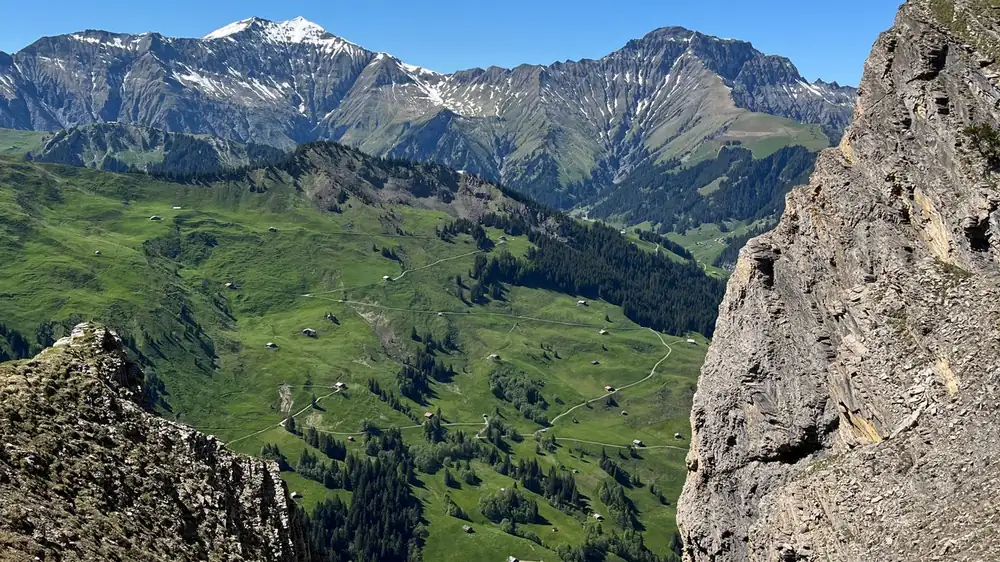
Official notes describe alpine pasture below the top, potato farm activity in season, and wide views toward both sides of the divide. There is no town at the pass. Facilities are limited. Carry what you need.
What to carry (family list)
- Warm jackets, caps, gloves (even if Srinagar felt mild at 9 am)
- Closed shoes with grip
- Water and dry snacks (do not depend on stalls at the top)
- Basic medicines your kids already use; altitude awareness
- Power banks and offline maps downloaded
- Cash for small stops (network can be patchy)
- Printed or saved TCU phone numbers
- Bin bags for trash (carry it back)
Cab and vehicle notes (no invented fares)
A Sinthan Top family day needs a driver who knows NH-244 hairpins and is willing to respect cut-off timings. Innova-class or similar MPV space helps when kids and jackets fill the cabin. We do not print a fake rupee rate here. Ask for a dated written quote that states:
- Round trip from your Srinagar hotel
- Waiting time at the top
- Driver food / night rules if the day runs late
- What happens if traffic police close the pass after you start
Start the enquiry on cabs.d2holidays.com or cab service. For a full holiday that includes south Kashmir without forcing every high pass, use packages#enquiry.
Who should skip Sinthan Top this week
- Families who need a short day (under 6 hours total)
- Anyone uncomfortable with long mountain roads and hairpins
- Trips planned when IMD shows heavy rain or snow for the Anantnag–Kishtwar belt
- Groups that cannot leave Srinagar early enough to honour cut-off windows
A calmer alternative day is Pahalgam valleys or a Kokernag garden stop. Ask our Boulevard Road desk which fits your kids' ages.
Toilets, food and phone signal (parent notes)
Plan toilet stops at Anantnag and again around Kokernag or Daksum. Do not assume a clean facility at the pass itself. Pack tissues and hand sanitiser. For food, a packed lunch from your hotel or a simple meal in Anantnag beats hoping for a full kitchen at 3,784 m. Phone signal can drop on the climb; tell one relative your return window before you lose network. If weather turns, turn back early. A half-finished pass day with warm kids in Anantnag is better than a stubborn push into cloud and cold.
October and early November are when many families ask us about Sinthan Top before winter weather ends the easy window. Pair the enquiry with your wider Kashmir dates so we can say honestly whether the pass fits that week or whether Pahalgam valleys are the safer south-Kashmir plan.
FAQ
How far is Sinthan Top from Srinagar?
About 130 km by the usual Anantnag–Kokernag–Daksum route on NH-244. Plan roughly 4.5 to 5.5 hours one way in clear conditions, longer with family stops. Confirm road status before you leave.
What is the height of Sinthan Top?
Kishtwar district's tourism page lists Sinthan Top at 3,784 metres above sea level. Keep outdoor time short at first if children are new to altitude.
Is the Sinthan Top road open right now?
Last checked against the 29 Sep 2026 Traffic Police advisory: NH-244 via Sinthan was open to LMVs/private cars subject to weather, road condition, and agency clearance, with daytime cut-off windows. Re-confirm on your morning with TCU Srinagar (0194-2450022, 103) or the latest Traffic Police notice. We do not invent open/closed status.
Can we take small kids to Sinthan Top?
Many families do, with early starts, warm clothes, and short time at the top. It is a long day. If your child hates long car rides, choose a closer south-Kashmir stop instead.
Do we need a special permit for Sinthan Top?
For the standard tourist approach from the Anantnag–Daksum side, operators generally do not describe a separate tourist permit beyond normal ID and traffic rules. Always follow instructions at any checkpoint on the day. We will not invent permit fees.